
RIVERSIDE DEVELOPMENT FOR 132 PREMIUM HOMES

RIVERSIDE
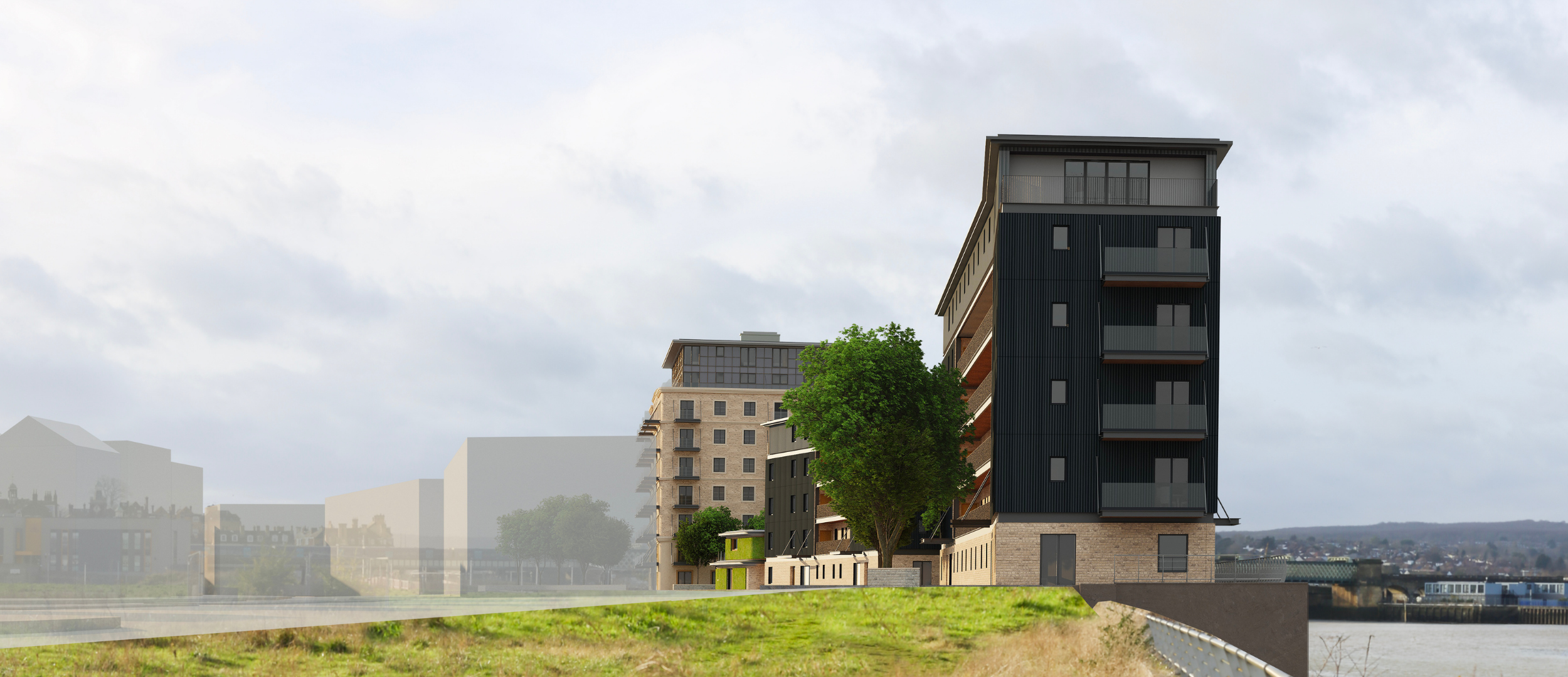
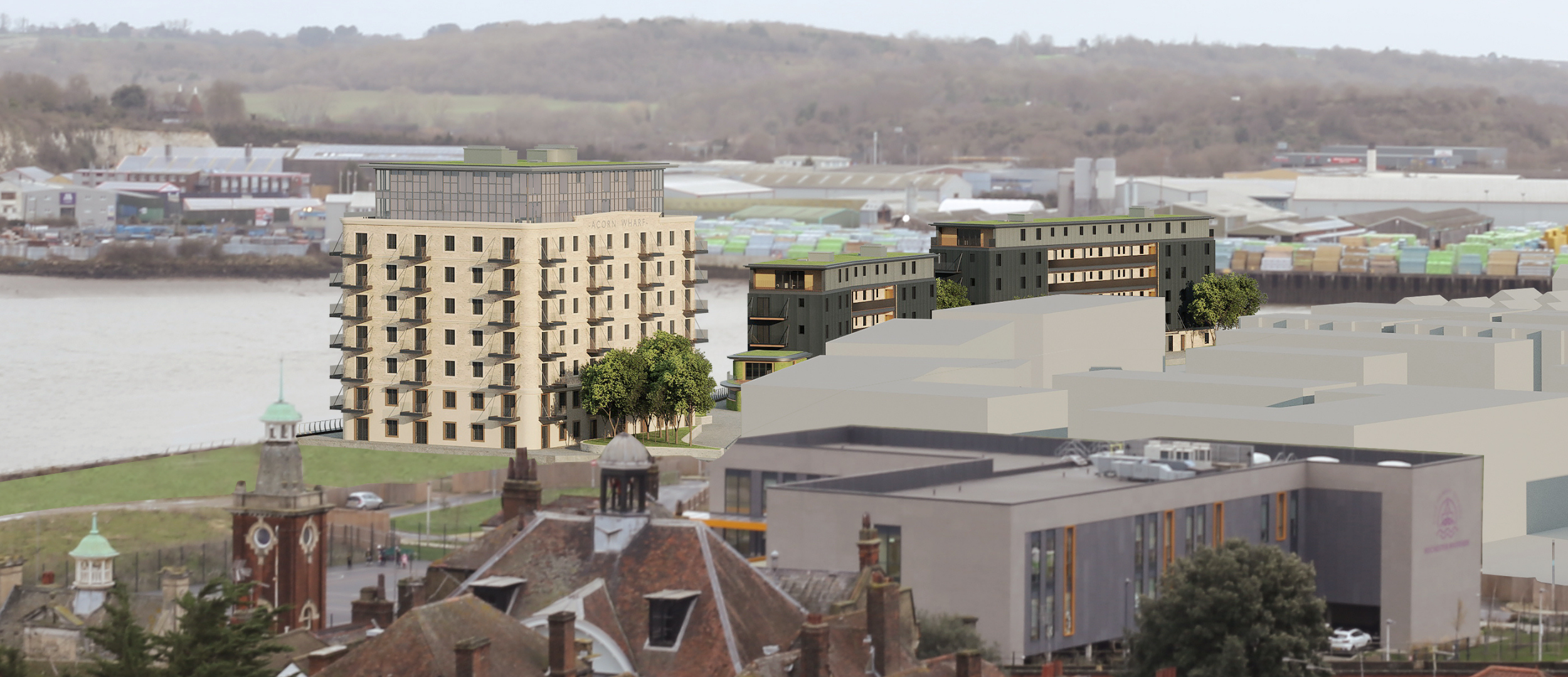
Historic Acorn Wharf on the River Medway, integrated with the wider Rochester Riverside masterplan and river walk.

Connectivity
Around 8 minutes to Rochester Station on foot, around 7 minutes to the High Street, fast links to London for young professionals.

HERITAGE
Authentic shipyard character, preserved slipway and crane, moorings potential, and a nod to the Medway Queen.
THE DEVELOPMENT
Full planning permission for approximately 132 residential apartments, plus commercial and community space.
Block A

76 apartments
Mix:
40 × 1-bed (2-person)
28 × 2-bed (3-person)
8 × 2-bed (4-person)
Primary residential building with river outlook and lower ground parking.
- Suitable for Build to Rent configuration
- Amenity and cycle storage provision

Block B

Commercial or community facility, approx 135.4 m².
Flexible ground floor space supporting activation and community use.

Block C

20 apartments
Mix:
14 × 1-bed (2-person)
6 × 2-bed (4-person)
Compact residential block aligned with the riverside character.

Block D

36 apartments
Mix:
12 × 1-bed (2-person)
16 × 2-bed (3-person)
8 × 2-bed (4-person)
Residential block completing the riverside sequence.

Café Pavilion

Approx 30 m²
Small pavilion activating the waterfront and supporting the river walk.


-
Acorn Wharf can support a range of delivery strategies. These include Build to Rent with contemporary amenity, Private Rented Sector with professional management, and a co-living variant aimed at young professionals who value location and connectivity.
Any alternative tenure mix or material changes may require further approvals.
-
Refuse and recycling stores are provided with direct surface-level collection, sized in line with Waste Management Requirements: New Developments 2019.
Fire service access is designed for forward entry and exit, with appliances able to stop within approximately 18 metres of each building, and with suitable firefighting and escape provision as set out in the Gateway 1 Fire Statement.
Full details are in the technical pack.
-
Vehicular access is proposed through the adjacent Rochester Riverside development to separate movements from school traffic.
Parking is principally at lower ground level, with resident and visitor spaces, and cycle storage aligned to local standards.
Total car parking across the site: 128 spaces
• 101 resident spaces (14 are disabled)
• 22 visitor spaces
• 2 unallocated disabled spaces
• 3 car-club spacesCycle parking: 132 secure cycle spaces in several small stores aligned to each block (meets local standards).
Final details are available in the technical pack.
Location and connectivity
The site sits on the river, close to the historic core of Rochester. Walk to the High Street in around 7 minutes, walk to Rochester Station in around 8 minutes, then connect by fast rail into London. The scheme ties into the wider riverside masterplan, public realm and local education provision.
Rochester Station - approx. 8 min walk
Rochester High Street - approx. 7 min walk
Direct Rail Services to London from Rochester Station
St Pancras International - 37 mins
London Bridge - 42 mins
London Victoria - 48 mins